Government Incentives and Tax Credit Book

On the heels of my five-part miniseries about cities, I’m excited to announce the publication of the Kindle edition of Government Incentives and Tax Credits from Subcity Press. The paperback version will be released next week on January 9th.

This book is a short primer on government incentives and tax credits for accountants, bookkeepers, and CPAs who work with small and medium-sized businesses. We are already the #1 new release in Governmental Accounting and top 10 in Small Business Taxes…two blockbuster categories :)

This is the second edition of the book my co-founder Gil first published in 2019 that has become the top search result for “government incentives for small business book.”

Since these economic incentive programs are always changing we are simultaneously releasing subcity.com/book as the companion site where you can see up-to-date programs by state and finance professionals can generate personalized incentive reports for their small and medium-sized business clients.

Please purchase and review, share with accountants, bookkeepers, or CPAs in your life, or simply let me know if you want a physical or digital copy and where I should send it!

Electricity, Water, Trash, and the Logistics of Operating A City like New York [5/5]

I am writing a five-part miniseries about cities to consolidate and record my learning about urban planning and economic development. These thoughts represent a synthesis from books, talks, podcasts, conversations, documentaries, and our work at Subcity. Part IV is Four Counterintuitive Ideas About Cities and this is the final piece in this series.

Dall-E Prompt: new york city above ground and below ground visualization with subway pipes

Kate Ascher’s book, The Works, is a visual and fascinating guide to what is required for a city like New York to function. While she covers dozens of aspects from moving people, moving freight, power, and communications, I’ll focus on a few areas to highlight interesting facts about these essential systems.  

Electricity. 

On Sept 4, 1882 Thomas Edison “flipped the switch” to begin operations at the Edison Electric Illuminating Company at his new Pearl St generating station. There is still a plaque marking the location in lower Manhattan. Over one hundred years later there is now 80,000 miles of underground electric cable (enough to go around the world 3.5 times) and 250,000 manhole covers across the city. 

NYC’s power infrastructure must maintain 5M+ air conditioners, 7M+ TVs, 9M+ cell phones, and millions of computers. Despite these massive numbers, there is benefit in the dense population. The average New Yorker consumes 2,000 kilowatt hours per year, compared to 4,000 for the average American. 

New York State’s power grid is among the most complex and congested in the nation, involving more than 330 generating plants. This is all coordinated through an organization called New York Independent System Operator, or ISO. Since electricity cannot be stored, the organization is tasked with constantly matching supply and demand. 

1. Each morning it accepts offers from generators that have energy to sell the following day. It takes bids from utilities looking to buy energy for the next day. 

2. After sorting the offers by price NYISO selects supply offers until all purchase bids are met; the last supply offer sets the price all buyers pay and all sellers receive. 

3. Since supply and demand fluctuate throughout the day, last minute adjustments are made roughly every six seconds. 

New York City still leans on an unusual power source, Steam. If you’ve ever seen steam billowing out of an orange and white cylinder vents - that is the steam coming up from its underground pipes. The vents are used to carry the steam above the windshields of passing cars. The United Nations Building, Empire State Building, Rockefeller Center, and the Met are just some steam users for heating, air conditioning, and hot water. Steam represents 7% of ConEd revenue. 

Water. 

1.3 billion gallons of water flow each day from reservoirs miles away to the 5 boroughs. The collect pond - near Franklin and Pearl St., was the first source of water for the young city.  Yellow fever and cholera epidemics in the 1800s caused the city to look further for fresh water. 

● First, the Croton river in Westchester was dammed and there was a Yorkville receiving reservoir and then Murray Hill distributing reservoir (now the site of the NYPL at Bryant Park). This required 30 miles of tunnels.

● Next, the Ashokan Reservoir was created. This required a 92-mile aqueduct. 

● Finally, the Delaware System of reservoirs was built. This water source is over 125 miles away and needs to travel through a system of tunnels and aqueducts. It now provides over half of the city’s water. 

The entire water system for New York City is 18 reservoirs. It involved the flooding of 30 communities and displacement of 9,000 people. On top of that, 11,500 graves had to be dug up and reburied. In order to bring water safely from Upstate NY throughout the city, massive water tunnels need to be built. Water Tunnel No. 3 is the largest capital construction project in New York City history. The tunnel will be more than 60 miles long, travel 500 feet below street level in sections, and will cost over $6 billion. Construction began in 1970 and is expected to be fully completed in 2032. The tunnel will serve as a backup to Water Tunnel No. 1, completed in 1917, and Water Tunnel No. 2, completed in 1936.

Waste. 

Each day, New York produces about 12,000 tons of residential and municipal waste. Since 1957 commercial waste from businesses has been left to private haulers. 10,000 employees and almost 6,000 vehicles work to collect and dispose of this waste. Their additional responsibilities include snow clearing during Winter, confetti and trash clean up after parades and New Year celebrations, and other random assignments like disposing of Christmas Trees in January.

Where does the garbage go? Two-thirds of it ends up in landfills in Pennsylvania and the rest in Virginia. There are 66 transfer stations around the 5 boroughs where the garbage is loaded onto larger trucks for long-distance travel to remote landfills. For just one example, each day, a train of 35 cars of containerized garbage pulls out from a warehouse at the Harlem River Yards in the South Bronx destined for Waverly, Virginia...400 miles away. 

Metal, glass, and plastic are collected separately from paper and currently delivered to one company - Hugo Neu - which barges the recyclables to its plant in Jersey City. 

Underneath the city, there are programs and infrastructure designed to support the buildings, equipment, people, and jobs - the very things that have always made cities engines of upward mobility for humanity. These enormous energy, water, and waste systems operate in the background and ensure that the city not only functions but thrives. 
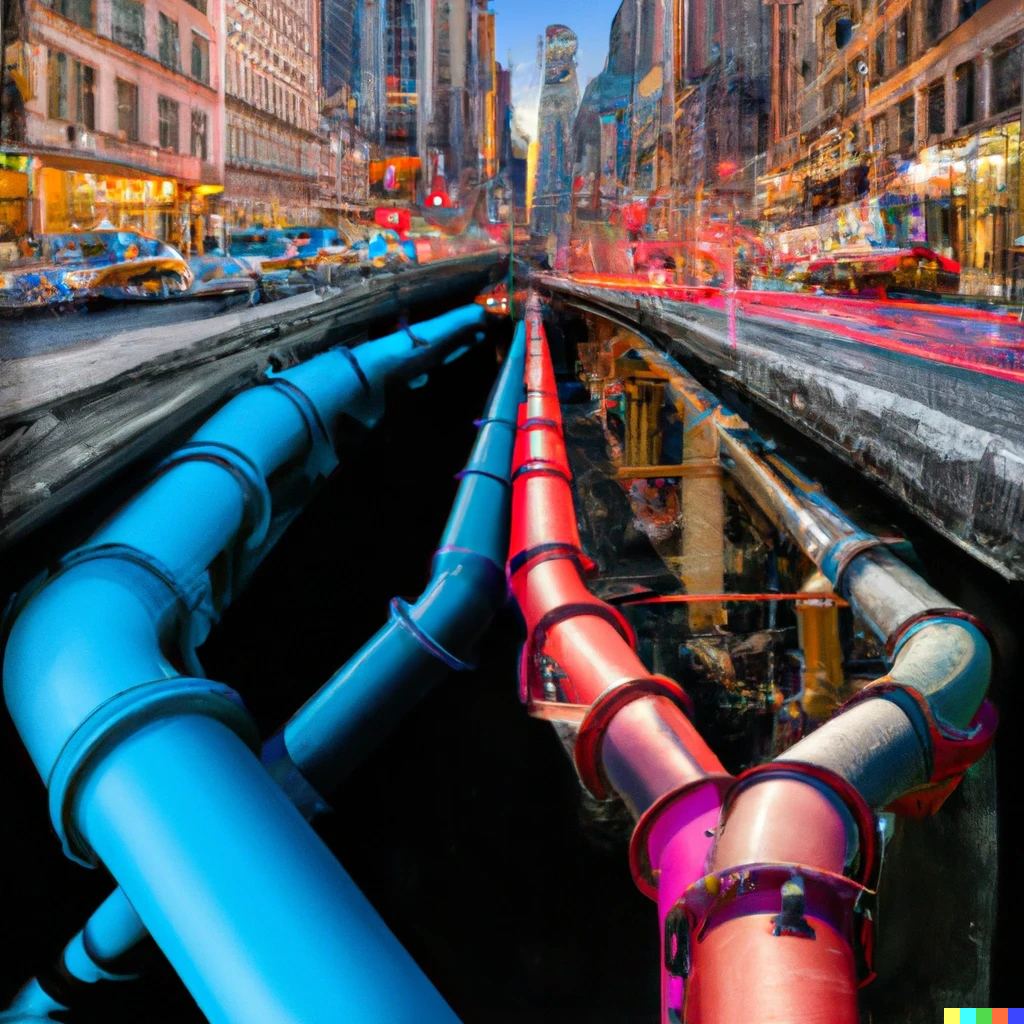
Four Counterintuitive Ideas About Cities [4/5]

I am writing a five-part miniseries about cities to consolidate and record my learning about urban planning and economic development. These thoughts represent a synthesis from books, talks, podcasts, conversations, documentaries, and our work at Subcity. Part III is  The Role Of The Military In City Planning 

“Underneath the city, there are programs and infrastructure designed to support the buildings, equipment, people, and jobs - the very things that have always made cities engines of upward mobility for humanity.”

-Everywhere Ventures (Subcity investor)

Dall-E Prompt: geometric big cityscape aerial shot colorful circle

Who hasn’t sat in their stationary car and wished for another lane so they could get home to be with family? For a city visitor or resident, there is a lot that can be intuited about how to improve things. And many of these ideas have been implemented over the years precisely because they seem so straightforward. But what we’ve learned is that many of these plans have unintended or disastrous consequences that we’ve had to re-learn many times, often in the same city!

Traffic Begets More Traffic

Study after study shows that building additional lanes does not increase traffic flow. Instead, additional lanes induce people to purchase more cars and use them instead of other modes of transportation. The Power Broker details story after story of Robert Moses expanding highways, building additional bridges, and within a few years causing more traffic, slower travel times, and more cars on the road than would have been predicted just with population growth and migration. 

A recent study of 100 US cities found that – between 1993 and 2017 – billions were spent to expand highway systems’ capacities by 42%, far faster than the cities were growing population-wise. But instead of reducing congestion, traffic delays actually went up by 144%.

Separation of Functions Leads to Dead Zones

Fast food chains, new car lots, and other types of businesses can cluster together and increase sales by being “destinations” rather than spreading out throughout a city. One might think that cultural institutions like operas, concert halls, and art museums would follow the same principal. 

Places like Lincoln Center in New York City or the Civic Center in San Francisco become vibrant hubs during showtimes or public hearings, but they often languish in off-hours, becoming magnets for crime and danger. The heartbeat of a city thrives on diversity—office workers, residents, retailers, and visitors all play their part in sustaining the urban ecosystem. The separation of functions, like an ecological imbalance, can lead to lifelessness in the very heart of a city.

Light Rail, Subway, and Metro Isn’t Egalitarian or the Best Use of Municipal Funds

A common belief is that subway and rail service allowed people of all income levels to live further away from centralized business districts. While streetcar suburbs and the growth of the flat-fair metro system in NYC and other municipalities has been an opportunity equalizer, it comes at a gigantic cost. As with roads, each dollar invested in one transportation method means it is not invested elsewhere. The strongest case for economical, sustainable, flexible, and equal opportunity transport? The good ol’ bus. 

There is No “Organic” Development of Cities

When we think of settlements, there is the romanticized wild west notion of setting out with your family and settling down in the open country. The last Homestead Act claim was in 1979 Alaska. There really hadn’t been any “organic” city development for the last 100 years. Even before then the position of railroads throughout the country dictated the towns and junctions. Nowadays, there needs to be transportation (which means roads). Water, sewer, electric lines need to be defined, and a whole host of city services need to be available. So, the next time you find yourself gazing at the endless lanes of traffic or pondering the separation of functions, remember that the intricate web of city planning often conceals hidden, counter-intuitive truths.

The Role of the Military in City Planning [3/5]

I am writing a five-part miniseries about cities to consolidate and record my learning about urban planning and economic development. These thoughts represent a synthesis from books, talks, podcasts, conversations, documentaries, and our work at Subcity. Part II is The Importance of Transportation in Cities

“Underneath the city, there are programs and infrastructure designed to support the buildings, equipment, people, and jobs - the very things that have always made cities engines of upward mobility for humanity.”

-Everywhere Ventures (Subcity investor)

Source: Boston Public Library. Army and Navy marching, first men to World War l, Tremont Street at the corner of Dover Street and Berkeley Street. 1917

We like to think that ancient townspeople fought savagely against each other, a constant clashing of swords and thundering of hooves. Yet, according to Lewis Mumford, the primary defensive concern early humans faced was from wild animals—not other people. Humanity did not switch from hunting and gathering to farming all at once, so Mumford and other scholars believe that the hunters that coexisted with the agricultural communities would have provided periodic service in the form of killing dangerous area animals. A lion or other large predator that was menacing the population would be tracked and put to rest by a “hired gun.” Even if there were no dangerous animals in the vicinity, these hunters could also have provided meat to supplement the citizen’s agrarian diet. 

Due to the irregular nature of hunting, these early warriors would have needed significant territory and would have had to engage with multiple settlements where they could provide meat and protective services in exchange for lodging or domestically grown and produced meals. The evolution of this practice from a harmonic relationship to something more sinister would have occurred as the settlements gained in stability and the hunters gained in hunger or greed. Like the mafia, what starts as cooperation can easily slip into shakedowns. Mutually assured destruction philosophy from the Cold War also played out in prehistoric times as villagers needed to arm themselves should the hunter’s next visit not be welcome. The bronze age, where weapons evolved from clubs and spears to swords and shields catalyzed an arms race that continues to this day at the nation-state level. 

It is here where we come to one of the oldest military technologies present across all civilizations. The wall. It’s evolved from mounds of dirt and wooden fences, to electrified and “smart” but the purpose remains the same. A safe space for those inside, and the manufacturing of an “us” vs. “them.” Even Wall Street, a symbol of financial power today, was once a wooden barrier built by the Dutch to protect the fledgling colony from Native American tribes. 

The opportunities and community offered by cities has always acted as a strong magnet but, during medieval times, to stay outside the city walls invited almost certain harm. Like Yale’s New Haven campus today, the gates were closed at night and opened each morning with the protection of the defined group sequestered from the “other.” As discussed in The Location of Cities, many of these walled towns would be located on water. The gate against the water would become the default port to receive goods and people. The word port is derived from “portal” as the handoff point between the boat’s cargo and the city gate, and its progeny became the seaport and ultimately the airport. 

As weapons and technology improved, the walls needed to strengthen against attackers. When simple dirt, wood, or stone walls sufficed it was easy to expand a village’s walls to accommodate additional land and people. As the wall height rose and construction became more costly, it became less practical to expand the walls of the city. This limited the outward expansion and ushered in an era of urban density. This collective effort of wall construction, expansion, and upgrading became the earliest public works projects for a society. Its success would have required political leadership, taxation, a class of workers skilled in construction, and the ability to organize and coordinate raw materials, labor, and set exact perimeters. 

Modern-day Istabul, Turkey, sits between two magnificent continents, Europe and Asia. The land route between the two, popularized by the writing of Marco Polo, must pass through the city due to the surrounding terrain. As a Roman city, Constantiople was the capital of the Byzantine empire, was protected by water on three sides and five walls along its 14-mile entrance. Twenty-three armies had tried and failed to take the city until the Ottomans were able to do so in 1453, turning the city into the capital of their Islamic Caliphate and hostile to Christian states and travelers. With this chokepoint sealed, the race for a sea-route to Asia began amongst the European powers with the Portuguese, Spanish, Italian, Dutch and British and others sailing all the way around Africa, India, and the Philippines and launching the western explorations of Henry Hudson and, of course, Christopher Columbus. 

Dense city centers with small winding streets exemplify the classic medieval town. The narrow streets seem confusing and traffic-inducing now. When constructed, they were practical since walking was the only means of transportation for most of the population and the narrowness would have provided shade in the summer heat, as well as warmth from wind in the cooler climates. The proliferation of the horse and carriage, trolley, and ultimately the automobile, necessitated a widening of the roads. However, a larger driver in Europe of the widening was military and government leaders. 

Paris was the first Western city where walls were leveled by the king and replaced with wide boulevards. It was meant as a strong signal that the protection of the city could be served by France’s wider borders and military might. As the resources and importance of a large standing army grew, so did the need to display this strength. Battalions of goose-stepping soldiers interspersed with the latest in military hardware can’t charge through curving footpaths in the same way as they can down wide, straight avenues. 

Roman armies on the march would set up their camps in a standardized layout. This meant that all Roman legions knew where to find everything, even if delivering something to another camp. The layout followed a classical grid pattern with the generals in the center and two main roads intersecting at a perpendicular angle in the middle. The main street, Via Principalis, ran north to south and was very wide. These temporary camps would turn into forts and inspire the grid layout used in cities around the world. 

From the defensive walls that set outer city perimeters and forced urban density, to the widening of medieval roads for military processions, and the grid pattern modeled on marching Roman legion’s war camps, the influence of the military on cities is clear from our grandest boulevards, to the old walled city, and the layout of Main Street. 

Sources:

➢ The City in History, Mumford

➢ Rise of the Ottomans on Netflix

➢ Roman Army Camp - https://imperiumromanum.pl/en/roman-army/roman-camp/

The Importance of Transportation on the Layout of Cities [2/5]

I am writing a five-part miniseries about cities to consolidate and record my learning about urban planning and economic development. These thoughts represent a synthesis from books, talks, podcasts, conversations, documentaries, and our work at Subcity. Part I is The Location of Cities.

“Underneath the city, there are programs and infrastructure designed to support the buildings, equipment, people, and jobs - the very things that have always made cities engines of upward mobility for humanity.”

-Everywhere Ventures (Subcity investor)

Walking is the original, default transportation method for human beings. Ancient cities that have been excavated or outlined are all shockingly similar in their walking distance across —a diameter of roughly 1.5 miles that one could cover on foot in approximately 30 minutes (15 minutes from the center of town to the perimeter wall).

It is impossible to talk about the layout of cities without talking about transportation.

Cities may seem to develop organically but beneath the bustling surface are transportation decisions and priorities that guide how the “organic” growth of the city will unfold.

There have been three major waves of technology in transportation. Each has impressed its needs on the city and in turn helped shape the city itself. The first started as subterranean trains started running under bustling cities as it was easier to build there than aboveground. London’s metropolitan railroad, precursor to the Underground, was opened in 1863. In 1897 Boston opened its subway lines . New York City followed in 1904, and Philadelphia in 1907. The second big technological change brought the steam engine right into the heart of the city. This required a massive amount of land for rail yards and straight, continuous tracks from outside of the city. This fueled the rise of manufacturing and the interplay between cities and the interior. The third technological change was the automobile. Cars required paved or cobbled streets, fueling stations, and ultimately highways and byways, onramps and offramps. Subways, trains, and cars pulled residents from the concentrated downtown to the surrounding boroughs, suburbs, and counties. Each technological wave stretched the physical distance between home and work but the average commute time remained around 20-30 minutes. The ease and speed which one could get from home to work spurred development around exits, train stops, and subway stations on whatever path these modes of transportation followed.

Most recently, in the years before COVID-19, there was an explosion in micro-mobility. Scooters and rental bikes, most useful for the 1-2 miles between other longer-form types of transportation like planes, trains, and automobiles, were seen proliferating across cities around the world. During COVID-19, to foster outdoor dining, cities have closed miles of roadways to cars and opened them up to bikers, walkers, diners, and general greenspaces. There has been fierce debate if these changes will revert to cars or if this is the opportunity many have been waiting for to “reclaim” the city from the automobile.

The “15-minute city” is a movement championed by a diverse coalition of architects, developers, city planners, and civic leaders. This concept envisions that all a citizen requires, from groceries and child-care, to work and recreation, should be within a 15-minute walk…almost exactly the radius of the ancient city.

The Location of Cities [1/5]

I am writing a five-part miniseries about cities to consolidate and record my learning about urban planning and economic development. These thoughts represent a synthesis from books, talks, podcasts, conversations, documentaries, and our work at Subcity.

“Underneath the city, there are programs and infrastructure designed to support the buildings, equipment, people, and jobs - the very things that have always made cities engines of upward mobility for humanity.”

-Everywhere Ventures (Subcity investor)

Why do we live in specific metropolises and how did we settle on these specific coordinates instead of any other area on this vast planet? Have you ever wondered what compels us to collectively converge on specific locations on Earth? In One Hundred Years of Solitude, Gabriel Garcia Márquez wrote, “A person does not belong to a place until there is someone dead under the ground.” Humans are the only animal to consistently and deliberately bury the dead ceremonially. I’m going to argue that this simple fact drove the earliest decisions on the broad areas in which our ancestors chose to settle.

Unlike many solitary predators, humans have always been social creatures. The movement of these early hunters and gatherers in tribes across the earth was important for safety, for procreation, for camaraderie, and for basic survival.

In canvassing the landscape these early people would have identified locations of interest that satisfy our primitive needs: fresh spring water that bubbled year-round, private watering holes where the river’s current slowed enough to attract animals, shaded groves of fruit trees with sweet crop aplenty, natural rock caves sheltered from the elements. These natural features could be supplemented by human creations such as tiny rock cairns along a wooded trail, simple cave paintings, clearings of brush for fire pits, and special locations marking the final resting place of deceased members of the tribe.

From the earliest mounds to the towering tombs of the Egyptian Pharaohs, the location of the burial grounds held sacred sway over early man and would become the location of the first steady repeat visits and ultimately the earliest settlements. This transformed the land from natural, undifferentiated terrain to the immovable resting place of one's ancestors - worth maintaining, defending, and settling around. Revered locations like Jerusalem, Mecca, Lhasa, and Salt Lake City.

This proximity to deceased ancestors would eventually help drive a solution to the collective action problem. How can you get individuals to willingly sacrifice their lives to defend a settlement, hand over food and resources to a taxing authority, or generally act in the best interests of the community? A tribe member would be much more likely to listen to the chief and be a positive member of the tribe if they believed the leader was communicating with the spirits of the omniscient dead.

Within these ancestral lands, cities and towns sprang up near water. Humans need water multiple times each day for drinking, bathing, farming, and washing belongings. While the surface of the earth is 71% water, only 3% of that is fresh water and only 1.2% is drinkable, the rest of the fresh water is locked up in glaciers, ice caps, permafrost, or deep underground. The Yangtze. The Nile. The Tigris. The Seine. The Danube. The Amazon. The Thames. The Mississippi. The Rhine. Long, legendary fresh water sources with civilizations’ entire histories running parallel to their flows.

In addition to daily life, rivers proved the earliest method by which humans could reliably transport people and heavy cargo. The wheel itself, for land travel, was known early on and discovered on small children’s toys but the axle technology to carry real weight only came thousands of years later.

The founding of the settlement, and primarily the mode of transportation at the time, would determine the final location. Whether it was developed early in the era of agriculture, during bronze age warfare, the sea-faring colonial era, or modern times, would all have an impact. In the earliest settlements, with minimal resource competition between tribes and before irrigation technology, fertile soil with regularly flooded plains were optimal. With the rise of towns and inter-city warfare, strategic locations with elevated sightlines or natural mountain or water defenses would be most carefully considered. The ruins atop the Palatine Hill and the Acropolis illustrate these locations of strategic military importance within Rome and Athens. From the 16th century onward, natural deep-sea harbors that could support ocean-going vessels helped transform previous coastal villages into thriving port cities like Cape Town, Shanghai, Amsterdam, San Francisco, London, Hong Kong, Lisbon, and New York City. Railroads in the 19th century spawned cities like Chicago, St Louis, and other transit hubs. Finally, the automobile decoupled a city’s need to be near a natural or artificial feature. A nearby flood plain, deep seaport, strategic military location, or the intersection of major railroad lines were no longer key considerations and allowed more modern cities to be formed in a sprawling fashion. Cities like Phoenix, Houston, Atlanta, and Las Vegas have all ballooned in population since the end of World War II. Several cities in the Southwestern United States are literally in the desert and far from natural water sources, a truly modern occurrence.

Ultimately, though, they are all built on human desires of belonging and necessities—and in all our huge, 21st century global metropolises’ centers can be found burial grounds just like those sought by Garcia Márquez’s settlers.

Sources:

➢ The City in History, by Lewis Mumford

➢ The Origins of Political Order: From Prehuman Times to the French Revolution, by Francis Fukuyama

Paternity Leave With McKinley

I have officially been on paternity leave with our second daughter, McKinley Wynn White, since the start of the year. It has been a very special time getting to know her deeply and a nice change of pace from the usual working world. 

A huge round of applause to SiriusXM/Pandora and other companies with humane and generous parental leave policies. I consider myself very fortunate and am immensely appreciative of this benefit.  

As with Maeve, I spend about a third of my time trying to get a tiny, sleepy human to go to sleep. About a third of my time changing, feeding, bathing, and playing with her. And about a third of the day, mostly while she is asleep, I get to read, watch TV, and listen to music, comedy, and podcasts.  

My intellectual focus this leave has been cities. I’m obsessed with complex, adaptive systems and collective intelligence and it doesn’t get more dynamic than the city. Living right near the World Trade Center and working across from Grand Central I get to experience all of the pros and cons of daily life alongside millions of other people. The early morning delivery of produce to the grocery stores, the shift workers preparing for the lunch rush, the construction crews taking a quick smoke break, and thousands of people on a mission to wherever they are going.  

Source: https://commons.wikimedia.org/wiki/File:2014_New_York_City_aerial.jpg

I’ve been reading a book a week about cities, a list I’ve been keeping over the years and never had the time to get to. This has been an excellent foundation for me in the origins, purpose, growth, contentious issues/benefits, and prospects of cities. 

  1. The Works, Anatomy of a City

  2. Happy City - Montgomery

  3. Death and Life of Great American Cities - Jane Jacobs

  4. Triumph of The City: How our greatest invention makes us richer, smarter, greener, happier, healthier

  5. The City in History - Mumford

  6. How Cities Work - Alex Marshall

  7. The New Geography of Jobs - Enrico Moretti

  8. The Power Broker - Caro (which I’ll probably be reading for the next year)

Later reading will focus deeper on individual cities and the myriad issues that need to be discussed when talking about the urban environment: politics, economics, transportation, diversity, housing, inequality, etc.

To supplement this reading I’ve been watching relevant documentaries and listening to podcasts (h/t to Stefan Martinovic for the recommendations!)

New York by Ric Burns is a 17 hour, 8 episode documentary covering NYC from the 1600s to present day. It originally aired on PBS and was a masterpiece. It is available on Amazon Prime and I highly recommend it. I also watched Urbanized and the Pruitt-Igoe Myth, a rich history of the life and legacy of the Pruitt-Igoe housing complex in St. Louis, an urban renewal project that suffered from neglect, vandalism and crime and was eventually torn down.

I’ve listened to several podcasts but had a harder time finding ones that really captured my attention. Podcasts include:

  • 10 Blocks

  • The City

  • Crimetown

  • Curbed Appeal

  • City of the Future

  • There Goes the Neighborhood

  • The Stakes

  • The Urbanist

  • Behind the Bricks

  • Technopolis

I found There Goes the Neighborhood, about gentrification in East New York, LA, and Miami, to be the most compelling. 

Other interesting things -- 

With Officer Reyes in the 40th Precinct, Bronx, NY

Ride-Along with the NYPD

On Tuesday February 11th, I spent the morning with the NYPD as part of their community “ride-along” program. I reported to the 40th precinct headquarters in the Bronx at 8am after dropping McKinley off for a half-day at daycare. Officer Reyes and Officer Singh were called in to pick me up and I was given a bullet proof vest to be worn at all times. I offered to buy them coffee at the Dunkin’ perfectly placed across the street but they’d been out since 7 and were well caffeinated. They had a “caged” vehicle so I rode in the back, uncuffed but with the child locks on the doors. 

I learned SO much about the life of a police officer and how the city structures the police force! 

Each precinct is divided into 4 or more sectors that are patrolled by at least 4 officers at all times. They work in teams of 2 and generally cover the hotspots that history and software have identified as likely problem areas. They wait for jobs to come in from dispatch. Since it was early on a Tuesday morning there wasn’t much happening the first hour which gave them plenty of time to answer all my questions. This changed in an instant. A “heavy” job came in from our bravo sector: a mentally unstable man with a large knife. 

As the sirens come on and we burn through a red light at full speed swerving into the opposing lanes of traffic officer Reyes yells back - “we are flipping our vest cams on and aren’t going to be talking much.” 

Me: *double checks that bullet proof vest is secure for no reason and grips arm rests*

Within minutes 6 cop cars and the sergeant's black sedan were on site and the officers were lined up behind the officer carrying a giant clear shield. The man was just getting off the elevator and thankfully was compliant. He was cuffed and searched. The knife he had was a serrated blade about 9 inches long. He had a history of mental illness and had been drinking all night. We escorted him in an ambulance to the hospital and stayed with him until he was taken to the psychiatric ward for evaluation. 

Our next job was to check out a fire that had broken out at a restaurant (the FDNY had it under control) and then to two traffic accidents to take statements and information. They dropped me back at the precinct headquarters at noon and I went home to pick up McKinley and tell her all about it. 

The closest experience to my day with the NYPD was the safari we went on during our honeymoon. Lots of quiet observation and downtime punctuated my moments of sheer adrenaline. If you are interested in doing this yourself, here is the application

Bachelor Party in Vermont for my friend Jared! Lots of skiing, a snowshoe hike to the top of a huge mountain, and plenty of delicious craft beer. 

The gym in my building has 2 Peloton bikes and I did my first rides. I’m not a big stationary bike-guy but I loved the music and workouts! I can see what all the fuss is about. I’m alexanderswhite on there if you use Peloton and want to be friends. 

Did a lot more parent meetups this time! There is a fun group of new parents in Tribeca and amongst a good group of friends there are 5 newborns so many of the moms are on maternity leave right now. Super fun.

People Doing Cool Things

My cousin Brooke has launched an excellent podcast called The Grief Coach. The podcast helps demystify the etiquette, issues, and questions related to the loss of a loved one. It is professionally done and she is able to pack each episode with wonderful stories, memories, and practical advice. Check it out!

Liv Buli has launched Blue House Goods, a hand-curated shop combining her Nordic upbringing with her excellent design taste. Great for gifts or to enhance any area of your home!

Paternity Leave, Part II

I’m writing this on my last day of paternity leave. I’ve spent the last two months being with our sweet daughter, Maeve Susan White, helping her learn and grow. It has been incredible (and hard and fun and confusing and stressful and amazing and all the other feelings).

Alex and Maeve at the beach house Sept 2018

Like I’d previously described, I spend about a third of my time trying to get a tiny, sleepy human to go to sleep. We are working on getting her to put herself to sleep now, hard at first but getting better each night.

I spend about a third of my time changing, feeding, bathing, and playing with her. And about a third of the day, mostly while she is asleep, I get to read, watch TV, and listen to music and podcasts.

For the first time since summer vacations in high school it was very cool to abandon any sense of schedule and move totally to her rhythms. If she was up at 5:30 or 6, I was up. If she slept until 7:30 or 8, we slept in! We went on two walks a day - I think I walked every single block of lower Manhattan at least once. We found so many cool public parks and spaces and must have visited every museum within 1 mile of our apartment.

Alex and Maeve on a bench next to the Hudson River near the Statue of Liberty, August 2018

We spent a really fun week at the beach with Caroline’s family. Now Maeve has started daycare part-time to get acclimated.

Story time at day care

That has allowed me to go on longer runs, check things off my life backlog (hello new driver’s license, passport, library card, check-ups etc!), and do some things in the NYC area that I’ve always wanted to do these last two weeks. I watched cases argued before a three judge panel at the second circuit court of appeals, saw the spot in Weehawken where Hamilton was shot in his duel with Burr, visited the Cloisters, The Intrepid, and the Brooklyn Botanic Garden.

Adding to my list of podcasts from before, I’ve continued going wide and deep in the world of podcasts. Some of my favorites:

  • Anthropocene

  • The City

  • Slow Burn

  • Internet History Podcast

  • Intelligence Squared

  • Science Vs

  • Beautiful Anonymous

  • The Moth

  • The Drive

  • Northwestern Intersections

  • Turn on the Jets, Locked on the Jets, Let’s Talk Jets

  • The Rubin Report

  • In The Dark

  • Sleuth

  • Pop Culture Happy Hour

  • Dissect

I was also able to clear out my backlog of “Shows and Movies to Watch” - the TV/Movie landscape is so fragmented and frustrating as a consumer. It makes the $9.99/month music subscription for everything seem so simple!

Some of my favorites:

  • Ozark

  • Django Unchained

  • Ivory Tower

  • Zero Days (about Stuxnet)

  • Page One (about NYTimes)

  • Kids for Cash

  • Interstellar

  • Ken Burns Civil War documentary

  • Explained on Netflix

I was also able to read about about a book a week:

  • Scale: The Universal Laws of Growth, Innovation, Sustainability, and the Pace of Life, in Organisms, Cities, Economies, and Companies.

  • Life 3.0: Being Human in the Age of Artificial Intelligence

  • The Society of Mind

  • A Mind at Play: How Claude Shannon Invented the Information Age

  • A Gentleman in Moscow

  • The Score Takes Care of Itself

  • Origin

  • Healthy Sleep Habits, Happy Child


Parental leave was a great change of pace but it was NOT a vacation. I am ready to go back to Pandora on Monday and balance my Maeve time with the other parts of my brain. Things at Pandora move fast and I know I’ll have a lot to debrief on with the team. For starters, Pandora was acquired by SiriusXM 5 days ago. Never a dull moment :)